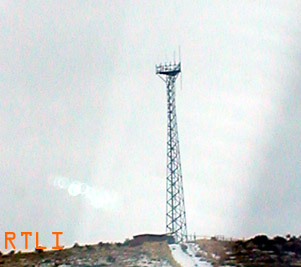
A celluar tower owned by
GoldenState Towers, LLC
Location: Montpelier,ID
Registration ID / Type: 1226376 / TOWER
Longitude: 111.2881 (111D 17M 17S)
Latitude: 42.3203 (42D 19M 12S)
Directions: Sec. 3, Twn. 13S, Rng. 44E, BM Landmark Hill
Elevation/Height: 1924.5 / 46.6 meters, 6314 / 152 feet
Just northeast of the tower above sits this hill...
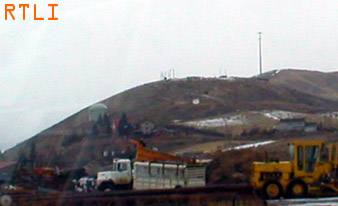
...where the celluar tower on top doesn't register on any database. Looks to be for a local company.
Georgetown
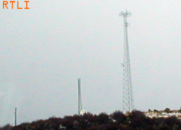
Both towers are owned by
GoldenState Towers, LLC
Location: Georgetown,ID
Registration ID / Type: 1226375 / TOWER
Longitude: 111.3996 (111D 23M 58S)
Latitude: 42.5251 (42D 31M 30S)
Directions: Sec. 26, Twn. 10S, Rng. 43E BM
Georgetown Summit, Hwy. 30
Elevation/Height: 1939.1 / 60.7 meters, 6362 / 199 feet
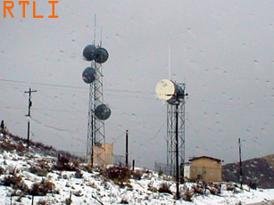
These towers are owned by the state of Idaho and apon closer inspection, there is no registration information to be found on them.