Kingman AZ
Back to AZ
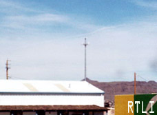
Outside of Kingman
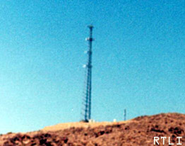
This tower is owned by a local celluar station. Several cell companies are present around
this area.
Relative location (within 1km) Longitude: 114.2591 (114D 15M 32S)
Latitude: 35.399 (35D 23M 56S)
It looks like it contains a cell extension housing several different companys.
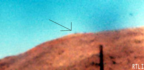
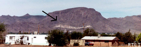
Getz Peak. This mountain contains a (ghost) tower by CSN
International, and an FM station KGMN.
Click the link to go to the FCC DATA. Relative loc...Longitude: 113.8817 (113D 52M 54S)
Latitude: 35.1097 (35D 6M 35S)
In town from west to east (or the rest of the
towers for several miles)
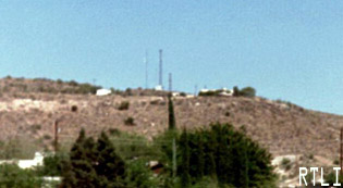
This small tower farm located on the western
side of town hosts the following uses
Park Lane Regency Radio inc.
American Tower l.p.
K244CV 96.7 FM (persumably the left one)
SBA Towers inc.
and thats about it
The northern part of town
The northern part of town is filled with cell
towers, heres an example (these are the real thing,)
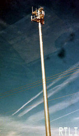
Company: SBA Towers, Inc.
Location: Kingman,AZ
Registration ID / Type: 1217784 / TOWERB
Longitude: 114.0169 (114D 1M 0S)
Latitude: 35.2192 (35D 13M 9S)
Directions: Beverly Avenue
Elevation/Height: 1049.4 / 44.1 meters, 3443 / 144 feet
Company: SBA Towers, Inc.
Location: Kingman,AZ
Registration ID / Type: 1226270 / TOWER
Longitude: 114.04 (114D 2M 24S)
Latitude: 35.2468 (35D 14M 48S)
Directions: 4255 Stockton Hill Road
Elevation/Height: 1059.2 / 42.7 meters, 3475 / 140 feet
Company: TowerCom West Coast, LLC
Location: Kingman,AZ
Registration ID / Type: 1215640 / TOWER
Longitude: 113.9939 (113D 59M 38S)
Latitude: 35.2564 (35D 15M 23S)
Directions: 4559 N.Castle Rock Rd.
Elevation/Height: 1013.8 / 60.7 meters, 3326 / 199 feet